Chittoor district
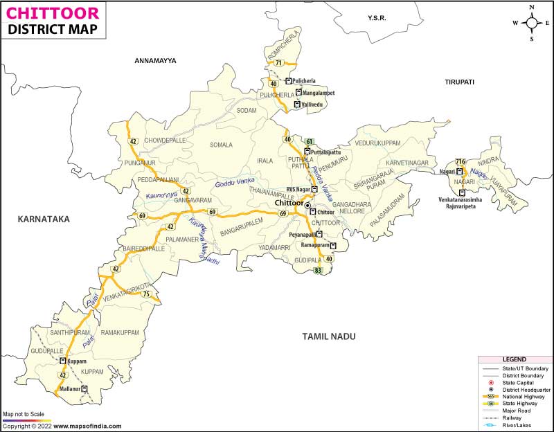
The district Chittoor ( Telugu: చిత్తూరు జిల్లా ) is one of 23 districts in the Indian state of Andhra Pradesh. The administrative center is the city of Chittoor.
Geography
To the north is bordered by the districts of Anantapur Chittoor, YSR and Sri Potti Sriramulu Nellore. Due to its location in the far south of the state he is bordered to the south and southeast by the state of Tamil Nadu and on the west by the Indian state of Karnataka. The western part of the district lies on a high plateau with a few rock formations and hills. The other regions of the district are located in the lowlands.
Chittoor is 15,151 km ² in area one of the largest districts of Andhra Pradesh (5.5 % of the area of Andhra Pradesh ). From the surface is 4520 km 2 ( 29.8 percent), forested .. The most important rivers in the district are Ponnai, Kusathali, Beema, Bahuda, Pincha, Kalyani, Araniyar and Pedderu.
Climate
The long-term average of rainfall is 934 mm per year. The south-west monsoon from June to September brings 438 mm (= 47 percent) and the Northeast Monsoon 396 mm ( = 42 percent ) of annual rainfall. Otherwise falls only a little rain. This leads to dehydration of the cultivated land in the dry season, which runs from January to Mai. The coldest month is January ( average 22.07 ° - 17 ° day minimum, maximum 27 ° ), the warmest May (average 29.72 ° - Minimum 24 °, maximum 36 °).
Population
At the last census 2011 4.170.468 inhabitants were counted. Of these, 2,083,505 were men ( 49.96 percent) and 2,086,963 women. Among the Dalits were 2001 702.320 ( 18.75 percent ) to the Adivasi 128 085 ( 3.42 per cent) people. Of the total number of inhabitants lived 2011 1.228.887 persons ( 29.47 percent) in urban areas. Thus more than 70 percent of the population lived in the countryside. The majority of the population of the district of Chittoor speaks Telugu. A significant linguistic minority are persons who use Tamil as their mother tongue. In the whole district there are 1,480 inhabited villages.
Population of the district according to confessions
A clear majority of the population belongs to the Hindus. Besides them, there are still a significant number of Muslims of more than nine percent. A smaller minority are Christians.
Demographics
As everywhere in India is growing, the population in the district Chittoor decades strongly. The increase between the last two censuses was 11.33 percent and is significant in absolute terms. From 2001 to 2011, the population grew by about 425,000 people. The exact figures shows the following table:
Significant places
Strongest town inhabitants of the district is Tirupati with more than 200,000 residents. Other important cities with over 50,000 inhabitants are the chief town of Chittoor and Srikalahasti.
Economy
The majority of the population is employed in agriculture. Due to the low rainfall of cultivation is difficult. Mainly mangoes, wheat, rice, peanuts and sugar cane are grown. There is little industry ( quarrying granite ), low mineral resources and trade ( especially with seeds and rice products).
History
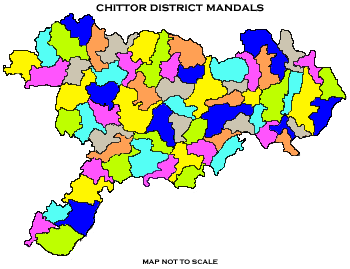
The district was formed on April 1, 1911 from parts of the former districts of Kadapa ( Cuddapah ), Nelluru ( Nellore ) and North Arcot. Politically the district is now divided into the three control districts Chittoor, Madanapalle and Tirupati and a total of 66 Mandals.


.jpg)


