River bifurcation
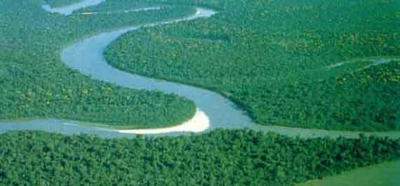
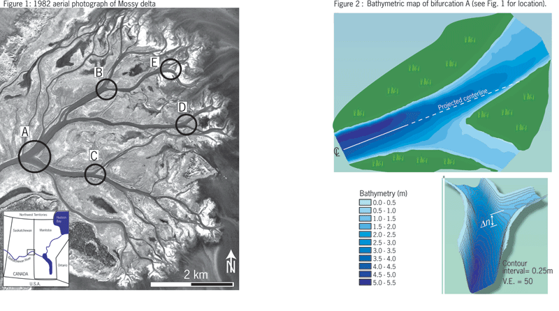
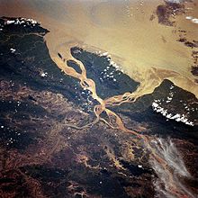
A bifurcation (from Latin furca = fork ) can be formed by a stream, when it enters into a shallow area of a watershed and to be branched in the catchment areas of two adjacent river systems. The water thus achieved via two different currents of the sea.
Types of bifurcations
From Pseudobifurkation is when swamps or lakes drained by different river systems towards.
It also distinguishes between permanent and periodic or ephemeral river and Seebifurkationen that are active only at high water levels. To connect to the lakes region of Minnesota, the Mississippi River system to the Red River and Lake Superior.
In karst areas occur underground bifurcations in phreatic or vadose caves active on ( underwater caves ). Well-known example is the infiltration of the river Danube with a subterranean connection to Aachquelle and therefore the catchment area of the Rhine.
Glaciers during the corresponding flow splitting is called Diffluenz - in contrast to the confluence, the confluence. In the flow of water currents within the glacier and the forms of underwater caves occur.
In addition, there are numerous artificial bifurcations to supply water to irrigation areas, cities and shipping canals, as well as in power plants, which can transport hydrographic significant amounts of water.
Examples
Bifurcations
- At the world's most important Flussbifurkation the Brazo Casiquiare branches depending on water levels 10-30 % of the water from the upper Orinoco to the Rio Negro, and thus from the Amazon system.
- The North Two Ocean Creek in Wyoming splits at the Two Ocean Pass on the Pacific Creek, which flows through the Snake River and Columbia River to the Pacific, and Atlantic Creek, which flows to the Gulf of Mexico via the Yellowstone River and Missouri.
- The Chiana joins the Arno, the Tiber River system.
- The Torne älv between Sweden and Finland loses half of its water through the Tärendöälven in the Kalixälven.
- The Else branches from the hare and flows over the Werre the Weser. The hare flows to the river Ems. The bifurcation near Melle - Gesmold (52 ° 12 '10 " N, 8 ° 15' 19" O52.2027777777788.2552777777778 ) was originally probably only periodically and was in the 15th or 16th century by a miller or by the owners of the castle Gesmold to use of water extended to a continuous bifurcation. As a result, one or the other arm was repeatedly filled with wars and quarrels.
- The mouth of the Datze (see below) in the Mecklenburg- Vorpommern Country ditch that flows from there westward to Peene and east towards Zarow.
- The Kroll Bach in Hovelhof divides into the Kroll Bach and the black water stream. The Kroll creek flows through the Haustenbach, the lip and the Rhine into the North Sea. The black water creek pours over the Ems also in the North Sea.
- The mill stream at Blumberg bifurcates at the edge of Ried in the apex region of the Aitrachtales. From here the Aitrach flows into the Danube and the Schleifebächle in the Wutachschlucht, ie towards the Rhine. The hydrographic network of Blumberg Ried is also a Pseudobifurkation (see below).
- The river Nerodimja ( Albanian: Nerodime, Serbian: Неродимка ) in Kosovo forks on the territory of the municipality of Ferizaj in one of the rivers Vardar and Lepenc the Aegean and in one of the Sitnica, the Ibar, Morava and the Danube to the Black Sea flowing part. An area of 13 ha around the bifurcation is excellent as a wildlife sanctuary. The bifurcation was artificially created in the 14th century. The artificial channel silted up, so he took scarcely more water. A few years ago this was repaired.
- In Rothenburg / Upper Lusatia in Saxony there are in the district Geheege a bifurcation of a small brook with no name, flowing out of the Biehainer peat. A portion of the water passes over the Spree and Elbe into the North Sea and the other over the Neisse and Oder into the Baltic Sea.
- On Zeinisjoch between Tyrol and Vorarlberg, the flowing down from Fädner Bach shares. The western half goes to the Ill and the Rhine to the North Sea, the eastern half of the Trisanna and the Inn River to the Danube and the Black Sea.
Pseudobifurkationen
- The largest lake in the world that drains in two directions is Wollaston Lake in Saskatchewan, Canada. From it spring from the Fond du Lac River, which drains to the Arctic Ocean, and the Cochrane River, which flows to Hudson Bay, and thus to the Atlantic.
- The Lapland Lake Rostojávri has a drain through Norway to the Norwegian Sea and through Sweden and Finland in the Bothnian Bay.
- The mountain lake Etang des Dougnes respectively. Estany de les Dugues drains into the Pyrenees for Tet and Segre, so the Ebro.
- Grimnitzsee: The water flows naturally to the north of the catfish in the Oder and artificially over a ditch and the Werbellinsee south into the Havel.
- The ( upper and lower) Ried in Upper Aitrach at Blumberg drained by both the Schleifebächle to Wutachschlucht and hence to the Rhine, and over the Aitrach the Danube.
- Numerous water bodies with stagnant apex region in glacial valleys: Datze, flows south into the Tollense and northward in the direction Landgraben.
- Small Country ditch flows south into the Tollense and northward into the Great Landgraben.
- Randow, flows northward into the Uecker and southward in the catfish ( standing apex region near the catfish ).
- The drainage network of the Red Lynx at Muencheberg drained eastward through the Stöbber the Oder and thus to the Baltic Sea and west through Stobberbach and Löcknitz in the River Spree, and ultimately into the North Sea.
- Ziese, flowing towards Danish Wiek and towards the river Peene.
- The Müritz, excluding the original natural course Elde towards the west an artificial east through the Old Müritz- Havel waterway ( Bolter channel Carpsee, Woterfitzsee ... ) to Havel
- Ruppin lake with Wustrauer Rhin and Old Rhin as effluents: Various Rhin- branches and canals flowing part of the water in the lower Havel, near, even at the mouth of the Elbe, another part on Kremmener Rhin and Ruppin channel in the Upper Havel Oranienburg.
- The lake Jezioro Chobienickie in western Poland, which is drained by the Obra River, a tributary of the Warta, also delivers water to the Lazy Obra, which flows into the Oder.
Artificial bifurcations
- Panama Canal consisting of the Río Chagres system, Lake Gatun. This artificial Pseudobifurkation represents the main shipping channel in the world
- Kaprun power plant in Austria: The tapped Pasterze am Großglockner drained to the south, the power homes even at the northern Alps.
- The jammed in the Vaud Alps in Lake Hongrin water is discharged to Lake Geneva and thus flows into the Mediterranean, while the inflow and outflow Hongrin part of the river system of the Rhine.
- Río Grande Fenix is divided in the town of Perito Moreno. An artificial channel leading to the Río Deseado, and thus to the Atlantic. The Río Chico Fenix goes to Lago Buenos Aires / General Carrera lake and thus over the Río Baker to the Pacific. Interestingly, the political background that led to the construction of this channel (see Río Deseado ).
- The artificial Altmühltherme About Director at Gunzenhausen in Bavaria directs the water from the Altmühltherme ( Danube river system ) to the Swabian Rezat ( river Rhine system ).
- The artificial Schiffgraben drained westward into the Ilse and the Oker and Aller and Weser to the eastward over the Great digging into the Bode and the Saale to the Elbe.


