Châtillon-sur-Lison
Châtillon -sur- Lison is a commune in the French department Doubs in the Franche -Comté.
Geography
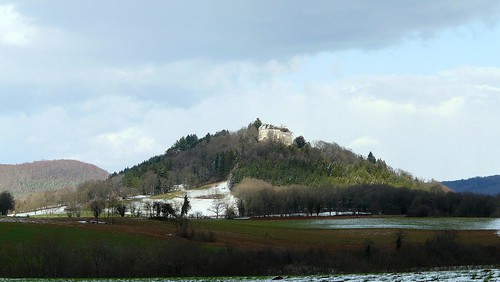
Châtillon -sur- Lison is located at 380 m, about 19 km south of the city of Besançon (air line). The scattered settlement extends in the Jura, on a plateau some 100 meters above the mouth of the Lison in the Loue, at the foot of the castle hill.
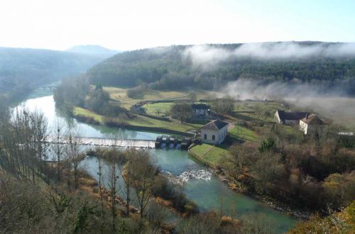
The area of 2.89 km ² municipal area includes a portion of the French Jura. The boundaries of the area to the east by the Lison and below its mouth by the Loue. These rivers move with spiral running in the valleys, which are about 100 meters deep into the surrounding plateau and its slopes are traversed in some places by distinctive Kalkfelswänden. The Loue flows in a 500 m wide flat valley floor. Of the rivers, the municipality's area extends westward to the adjacent plateau of Chatillon (370 m), the Castle Hill ( 464 m) is seated as witnesses Mountain and forms the highest point of Châtillon -sur- Lison. On the west, the area extends to the next higher layer level (up to 450 m).
The community consists of three hamlets:
- Les Forges (290 m) at the Loue
- Les Granges (380 m) on the plateau of Chatillon
- Le Château ( 464 m)
Neighboring communities of Châtillon -sur- Lison are Rurey and Lizine in the east, Cussey -sur- Lison in the south and Rouhe in the West.
History
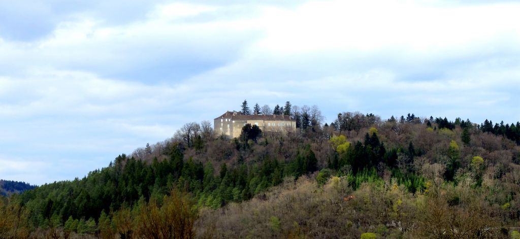
At strategically well-protected location on a hill above the mouth of witnesses Lison in the Loue a castle was founded in the 12th century. The castle belonged to the families of Châtillon and Chay Vaugrenant. Middle of the 13th century was another seat of power, the so-called Château- lingerie, built in 1479, however, the troops of King Louis XI. was destroyed. In the Middle Ages Châtillon made a rule, which was under the suzerainty of the lords of Chalon. Together with the Franche -Comté reached the village with the Peace of Nijmegen in 1678 to France. The possession of the castle was in 1767 by the Vaugrenant to the Mouret about. After 1808 there were several changes of ownership; among other things, kept the castle in the 19th century the owners of the iron works.
Attractions
The castle, which dates back to a former medieval castle was altered in the 16th and 17th century and completely restored in 1820. Among the natural attractions of the area include the picturesque valleys of Loue and Lison.
Population
With 11 inhabitants (as of 1 January 2011) Châtillon -sur- Lison is one of the smallest municipalities of the department of Doubs. After the population had decreased significantly in the first half of the 20th century (1891 58 people were still counted ), it is practically constant since the mid- 1970s.
Economy and infrastructure
Châtillon -sur- Lison has long been a predominantly coined by agriculture and forestry village. In the 19th century its importance rose thanks to the iron works. At that time the village had more than 300 inhabitants. With the cessation of operation the late 70s of the 19th century, however, most of the workers and families moved away. Today, the inhabitants live on the merits of the activity in the first sector. Outside of the primary sector, there are almost no jobs in the village. Some employed persons are also commuters who engage in the surrounding larger towns of their work.
The village is located off the major thoroughfares on a secondary road, leading from Épeugney by Salins- les- Bains. Further road links exist with Rouhe and Lizine.
Arc- et- Senans | Bartherans | Brères | Buffard | By | Cademène | Cessey | Charnay | Châtillon -sur- Lison | Chay | Chenecey- Buillon | Chouzelot | Courcelles | Cussey -sur- Lison | Échay | Épeugney | Fourg | Goux - sous- lands | Lavans- Quingey | Liesle | Lombard | Mesmay | Montfort | Montrond- le -Château | Myon | Palantine | Paroy | Pessans | Point Villers | Quingey | Rennes- sur- Loue | Ronchaux | Rouhe | Rurey | Samson
- Municipality in the department of Doubs
- Place in Franche -Comté


