Fürstenfeldbruck (district)
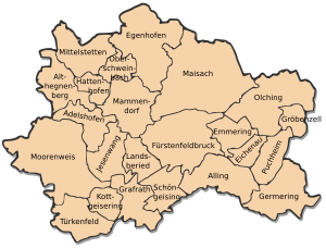
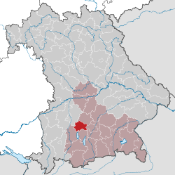
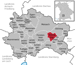
The district Fürstenfeldbruck lies in the west of the Bavarian administrative region of Upper Bavaria. Administrative center is the city Fürstenfeldbruck. Neighboring counties are in the northern part of the district of Dachau, in the east the district-free city Munich and the Munich County, south of the district of Starnberg, in the southwestern district of Landsberg am Lech in the northwest of Aichach- Friedberg.
- 3.1 District Administrators
- 3.2 Kreistag
- 3.3 Coat of Arms
- 3.4 District Partnerships
- 4.1 traffic
Geography
The district Fürstenfeldbruck can be geologically divided into four areas. To the east and southeast there is flat land with barren fields at the Munich gravel plain. In the far south, south of Moore Weis and Jesenwang there is an embossed mixed forests and meadows young moraine landscape, the BC was created during the Ice Age, between 100,000 BC and 75,000. To the north, the majority of the district is characterized by approximately the level of sub- Schweinbach through hilly Altmoränenland with fertile fields. This moraine formed during the Riss glaciation between 270,000 BC and 150,000 BC, so-called dead ice holes were made at the end moraines. This is around lakes that have silted up over time to bogs. As an example of such a Toteisloch in Fürstenfeldbruck the Haspelmoor can be listed. In the north, finally, about from a line Tegernbach at Mittelstetten (Upper Bavaria), sub Schweinbach and Überacker, is found only slightly rolling hills with loamy- sandy soil. Here prevail coniferous forests and deep fields.
The county is drained by the south to the north east of the Amper. Approximately parallel to, but further north flows the smaller Maisach.
History
The area of present-day district Fürstenfeldbruck has long been one of Bavaria. Beginning of the 19th century the two district court districts Dachau and Landsberg am Lech were built. From these two parts of District Courts to the separate district court Bruck was formed in 1823. It belonged to the circle Isar ( 1838 Upper Bavaria). 1862 of the same county was formed from the District Court of Bruck, which was renamed in 1908 in county Fürstenfeldbruck. 1939, from the district office district office and from the district, the county Fürstenfeldbruck. The local government reform of 1972 took the Fürstenfeldbruck only with small border corrections in the West.
Population Development
The district Fürstenfeldbruck won 1988-2008 nearly 27,000 residents added or increased by approximately 15%.
The population figures from 1840 onwards are based on the territorial status of 25 May 1987.
Policy
District administrators
- May 25, 1945 - June 5, 1946: Dr. Hans Miller (acting)
- June 6, 1946 - March 6, 1947: Hans Wachter ( CSU)
- March 13, 1947 - December 2, 1947: Ernst Raadts (BP )
- December 9, 1947 - May 30, 1948: Karl Huber ( CSU)
- June 1, 1948 - April 30, 1964: Ernst Raadts (BP )
- May 1, 1964 - December 31, 1971: Mathias Duschl (SPD )
- January 1, 1972 - June 30, 1972: Josef Reithmayr (FW), provisionally
- July 1, 1972 - April 30, 1990: Gottfried Grimm ( CSU)
- May 1, 1990 - April 30, 1996: Rosemarie Griitzner (SPD )
- Since 1 May 1996: Thomas Karmazin (CSU )
Council
Coat of arms
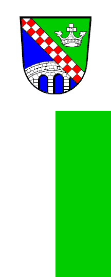
Blazon: "Through one of silver and red in two rows geschachten oblique beams divided by green and blue; above a silver crown prince, down a three-arched brick silver bridge. " geschachtete The oblique beams comes from the family coat of arms of the monastery founder of St. Bernard. The prince's crown symbolizes the Wittelsbach also involved in the creation, whereas the bridge represents the market Bruck. The design of the coat of arms dates back to the market until 1936 valid coat of arms and was officially introduced on June 30, 1967 by district council decision.
District partnerships
There is an official partnership with the present district of Greiz in Thuringia. This partnership was concluded in 1991 with the then still independent district Zeulenroda. In the course of municipal reform of 1994, the counties Greiz, Zeulenroda and parts of the counties Gera ( Gera district ) and Schmölln were merged ( county Schmölln ).
Economy and infrastructure
The district Fürstenfeldbruck divided both economically and from a much higher population density in two parts. While large-scale and medium-sized industry is located in the densely populated east, characterize the sparsely populated west especially farms.
Traffic
The district Fürstenfeldbruck is crossed by two main railway lines:
The Munich - Augsburg Railway Company took already 1839/40 their operation. Until the station Mammendorf (formerly Nannhofen ) run special tracks parallel to the S-Bahn line 3.
Also in 1873, opened by the Bavarian state railway line from Munich to Furstenfeldbruck Geltendorf is shared in the district from an S -Bahn (S 4).
Built in 1903 railway line from Munich to Herrsching now serves exclusively the transport of the S-Bahn line 8; it opens up in a circle, only the large district Germering.
The overall network is still being operated fully in passenger transport.
Major roads in the district are the highways 8 (Munich -Stuttgart ) and 99 with " Eschenriederspange " in the northeast and east, and the A 96 Munich -Lindau in the south; to the federal highways 2 and 471 that pass through the county.
Cities and Towns
(Population at 31 December 2012)
Cities
Management Communities
Communities
Towns and villages of the district before the municipal reform 1971/78
Until the local government reform in 1971/78, the district Fürstenfeldbruck had 59 communities ( see list below).
In the northwest, bordering the county to the county Friedberg, in the north- east by the district of Dachau, on the east by the county and the city of Munich, to the south by the district of Starnberg and southwest and west by the district of Landsberg am Lech.
The communities of the county Fürstenfeldbruck before the municipal reform 1971/78. ( The towns that still exist today, are written in bold. )
Attractions
In addition to the monuments and sights of the individual communities the Farm Museum Jexhof is worth mentioning. It is located in the south of the district, just off the road connecting Schöngeising - walls, as in a desert landscape trough on the western slopes of the nature reserve wild moss.
Geotopes
In the district to 6 (September 2013) are the Bavarian State Office for Environmental designated geological sites. See the list of geological sites in the district Fürstenfeldbruck


