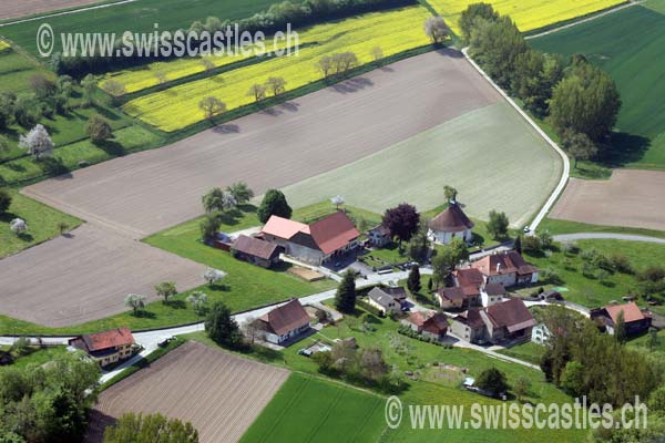
Chêne-Pâquier
Chêne- Pâquier
Chêne- Pâquier is a municipality in the district of Jura-Nord Vaudois in the canton of Vaud in Switzerland.
Geography
Chêne- Pâquier is located on 662 m above sea level. M., 10 km east of the district capital Yverdon- les- Bains ( straight line ). The scattered village extends Molassehügelland the northern Vaud Mittelland, southwest of the deep Kerbtals Vallon des Vaux.
The area of 2.1 km ² large municipality area includes a portion of the hill country between Lake Neuchâtel and the Broyetal. The main part of the territory occupied by the plateau of Chêne- Pâquier, in the southwest on the corridor Les Carralettes 725 m above sea level. M. reached the highest point of the municipality. In the east and north of the stream Ruisseau des Vaux forms in parts the border. North of Chêne- Pâquier this creek has cut a deep V-shaped valley in the molasse. A small part of its territory lies east of the Ruisseau des Vaux and includes the forest Braye (up to 714 m above sea level. M. ). From the municipality surface 1997 3 % was attributable to settlements, 25 % of forest and shrubs, 71% to agriculture and about 1% was unproductive land.
Chêne- Pâquier consists of the village of Le Chêne (662 m above sea level. M. ) the hamlet of Le Pâquier ( 638 m above sea level. M. ) in a small depression of the plateau and some single farms. Neighboring communities of Chêne- Pâquier are Démoret, Molondin, Chavannes -le- Chêne and Champtauroz.
Population
With 117 inhabitants ( 31 December 2012) Chêne- Pâquier one of the smallest municipalities in the canton of Vaud. Of the 94.2 % inhabitants are French-speaking, German-speaking 3.9 % and 1.0 % speak Serbo-Croatian (as of 2000). The population of Chêne- Pâquier amounted in 1850 to 224 residents in 1900 to 172 inhabitants. After a strong migration was recorded. Since 1960, the population remains fairly stable at 110 residents.
Economy
Chêne- Pâquier still lives mainly from agriculture, especially from agriculture and animal husbandry. Outside the primary sector, there is little employment in the village. Some employed persons are also commuters who work mainly in Yverdon.
Traffic
The community is located off of larger thoroughfares on a connecting road from Molondin by Chavannes -le- Chêne. By Postbus course, serving the communities of the hinterland from Yvonand Station, Chêne- Pâquier is connected to the public transport network.
History
The first mention of Le Chêne was in 1550 under the name loz Chanoz that is derived from the old French word for oak. Le Pâquier 1462 was the first time in 1517 named as Pascua, as Pasquier. This place name comes from the late Latin word pasquerium ( pasture, grazing land ).
Since the Middle Ages Le Chêne and Le Pâquier belonged to the lords of Saint -Martin- du- Chêne, its castle and borough were on the hill northwest of Le Pâquier (today in the municipality of Molondin ). With the conquest of Vaud by Bern in 1536 Chêne- Pâquier came under the administration of the bailiwick of Yverdon. After the collapse of the ancien régime, the village belonged from 1798 to 1803 during the Helvetic Republic to the canton of Geneva, who came up then with the enactment of the Act of Mediation in the canton of Vaud. 1798 was assigned to the district of Yverdon.
Attractions
The Reformed Church of Chêne- Pâquier stands in the hamlet of Le Pâquier. The church with an oval ground plan and excellent acoustics was built in 1667 to plans by the Bernese architect Abraham Dünz. It has a Renaissance portal and is plain on the inside. The last restoration took place from 1963 to 1973. In the village farmhouses are received, returning at the core to the 15th and 16th centuries. At Covet is a built in 1733 Bridge over the Ruisseau des Vaux.


.JPG/280px-KGS_Chene-Paquier-Kirche-(18).JPG)


