Albay
Albay is a province of the Philippines. It is located in the south of the island of Luzon in the Bicol Region (Region V).
Its capital is Legazpi City, the provincial governor Joey Sarte Salceda called.
- 5.1 Pre-Hispanic era
- 5.2 Spanish and American colonization
- 5.3 Japanese occupation
- 5.4 Policy Development
Geography
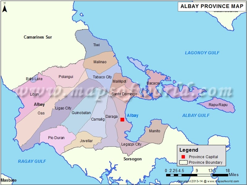
The province is located in the southeastern foothills of the island of Luzon and is bordered by the provinces of Camarines Sur to the north and Sorsogon to the south. To the east extends the Pacific Ocean, to the north lies the Gulf of Lagonoy and in the northeastern Gulf of Albay, both are part of the Philippine Sea. In the west and southwest turn the Burias channel, a lake road, which runs between the southern part of Luzon and the island Burias and marks the boundary with the province of Masbate is.
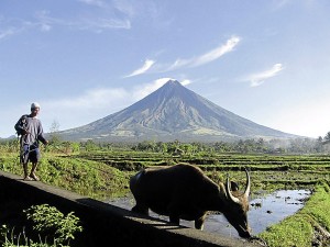
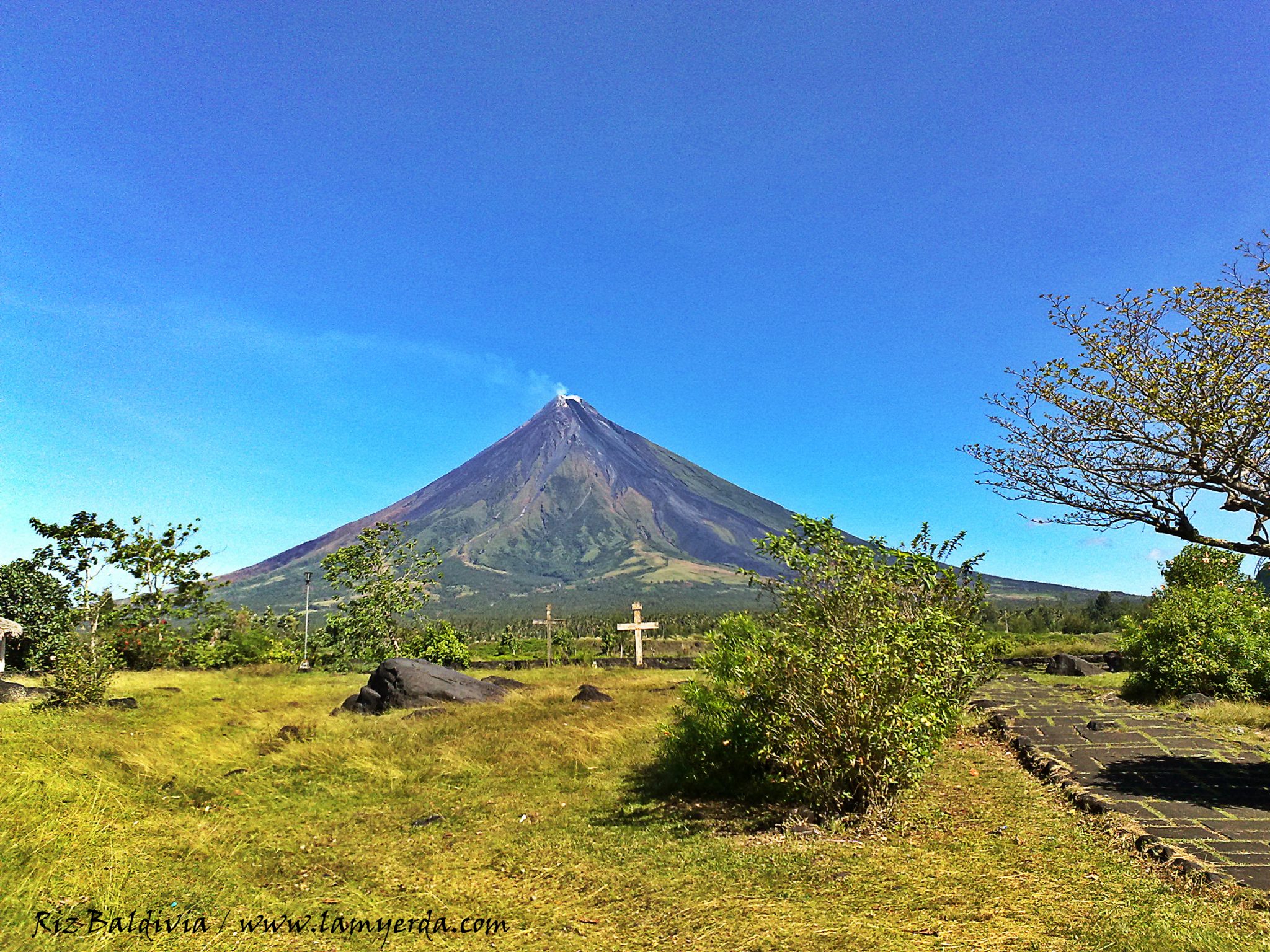
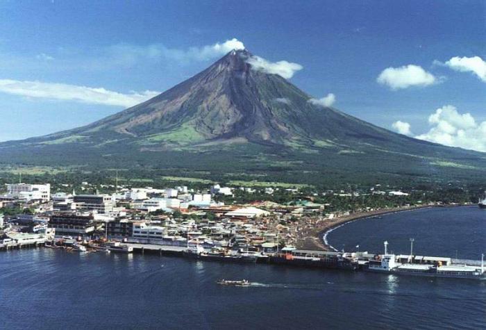
The symbol with which the province is most commonly equated with the Mayon Volcano. The impressive active volcano forms a scenic backdrop in front of Legazpi City, which extends about 15 km south of it.
Albay has heard a total land area of 2552.6 km ², which puts it in 26th place and one of the smaller provinces of the Philippines. The main part of the province area is located on the Bicol Peninsula. In addition, among Albay four larger islands, which are located in the eastern part of the province in the Pacific: Rapu Rapu -, Batan ( part of Rapu - Rapu of the community ), Cagraray ( part of the community Bacacay ) and San Miguel Iceland ( part Tabaco City).
The provincial profile is generally be described as mountainous, the hills are intersected by fertile plains and valleys. The Mayon Volcano with its height of 2462 meters, the spectacular landscape feature of Albay and the entire district Bicol Region. The almost perfectly shaped volcano is equated by many as one of the most beautiful volcanoes in the world with Mount Fuji in Japan. Other mountains and volcanoes in the province are the Masaraga, the Malinao, all located in the north and the Catburawan in the west of Albay. The wooded Pocdolberge are in the southeast of the province.
Demography and language
According to the census in August 2007, Albay is home to a population of 1,190,823 people, which puts them into the statistics to the 22 out of the most populous provinces of the country. This results in a population density of 427 persons per km ², making it holds the 10th place in this category. The inhabitants are spread over 208 640 households, which means that an average of 5.22 people living in a household, so a bit more than the national average of 4.99.
The main language of the province is Bikolano. Other common dialects are variants of Bikolanos how Viejo, Daragueño, Legazpeño or Albayanon, Oasnon and others. The spoken dialects in the coastal regions which are the province of Camarines Sur very similar, while each of the forms of speech in the country same with each other. However, they differ significantly from those of the coastal zone. Thus, there are significant differences within the various localities in both the variety of words, and in the debates. The biggest challenge here are the versatile variations that has evolved in so many words the same meaning for one and the same object or principle between the individual locations.
However, the majority of the natives! Beside the generally taught in school languages Tagalog and English.
Economy
The traditional main industry in Albay is agriculture. In the province of crops are mostly like coconut, rice, sugar cane, wheat and banana fiber, but also grown pineapple and various kinds of vegetables. Hand-crafted items, however, are the main source of income of the rural population. The forestry and paper industries are other important industries of the province. The production of abaca products such as Manila hemp, hats, bags, mats, and slippers are also significant sources of income that have particularly developed in this region.
The forest areas contain rich resources of timber, rattan, Pilinussbäumen and elemi. Furthermore, they offer the wide plains grasslands, which are used as pastures for horses, cattle, carabaos, goats and sheep.
The industrial areas of the province are the geothermal power plants in Tiwi and Manito, the Good Found cement factory in Camalig that Isarog paper and pulp mill in Daraga and Legaspi Oil Company and two other coconut oil mills in Legazpi City, which rises Albay into a leading industrial area in Luzon.
Along the coasts and islands of the province, however, the fishing industry is the most important, while developed around the Mayon a stronger and stronger tourism.
The province is with its ports Legazpi National, Pio Duran Provincial and Regional Pantao port a major transshipment point for goods from and to other ports in the country. Legazpi City also has a provincial airport with regular flights to Manila and the Visayas. A regular rail link between Manila and Ligao City, it is operated by the Philippine National Railways.
Political Structure
Albay is subdivided into 15 municipalities and 3 cities independently managed. Three of the communities. Polangui, Daraga and Guinobatan here are classified as towns in the first income category.
The towns and cities are in turn subdivided into a total of 720 barangays ( districts ).
The province is divided further into three districts Congress.
Cities
- Legazpi City
- Ligao City
- Tabaco City
Communities
- Bacacay
- Camalig
- Daraga
- Guinobatan
- Jovellar
- Libon
- Malilipot
- Malinao
- Manito
- Oas
- Pio Duran
- Polangui
- Rapu Rapu -
- Santo Domingo
- Tiwi
History
Pre-Hispanic era
Today Albay and the surrounding area was originally called Ibalon as 1569 a Spanish expedition under Luis Enrique de Guzman of Panay from the islands of Masbate and Ticao as well as the area of Ibalon explored. The Augustinian monk Father Alonzo Jimenez forced the Christianization of the indigenous population of Ibalon, Camarines and Burias. He became acquainted with the local dialect Bicolan and composed a catechism in this language.
In July 1573 a group of 120 Spanish soldiers followed, led by Juan de Salcedo, who founded the town of Santiago de Libong. A small settlement in an area surrounded by mangrove swamp was around 1616 with the name of Albay bay intent (which means meant as " at bay "). The town was later renamed Albay and finally got the name Legazpi, Albay after the term had been applied to the entire area.
Spanish and American colonization
1649 there was a rebellion of the locals who rose up against its convocation to Cavite, where they were provided for the construction of galleons. In 1814, a devastating outbreak of Mayon destroyed the town of Cagsawa in which 1,200 people were killed and let the place burn down to the ground.
During the early 19th century was fabricated from the abaca plant of the Manila hemp, which was used for the production of ships ropes and developed into one of the most valuable goods industry of the area.
On September 22, 1898 the revolutionary government was established in Albay province during the Philippine Revolution, the Anaceto Solano board as provincial president.
Although it was set up on 22 April 1901, Colonel Harry H. Bandholtz, the commanding officer of the Bicol region, an American-inspired civil government in the province, there were constant attacks on the new American rule. So led in 1901 during the Philippine - American War after the arrest of the Philippine General Vito Belarmino of the revolutionary Simeon Ola about 1,000 men in the fight against the American occupation forces. Ola was captured as the last Filipino general, together with six hundred of his men, which marked the end of the Filipino resistance.
Japanese occupation
In December 1941 combat troops entered the Japanese Imperial Army, the province area. So the Japanese Kimura command occupied on 12 December 1941, the City Legazpi City. The district was merely defended by a Philippine police unit under Major Francisco Sandico. On December 19, was the entire Bicol Peninsula down to Sipocot, Camarines Sur, in the hands of the Japanese attackers.
1945 began the liberation of the province by Filipino guerrillas and American troops who were able to complete the reconquest of the region soon.
Political development
In 1846, the islands of Masbate, Ticao and Burias were separated on the instructions of the Governor Narciso Claveria de Albay and formed now Comandancia ( headquarters ) Masbate. Albay was divided in this course into four districts: Iraya, Cordillera or Tobacco, Sorsogon and Catanduanes. 1894 Sorsogon became a province and Catanduanes followed in 1945. The Albay province itself was officially established on 10 March 1917.
Climate
Albay has three climate zones. The eastern areas have a temperate climate without a pronounced dry season, with the months of December and January conspicuous by increased rainfall. In the western regions more or less extensive rains come on throughout the year, while the central regions are spared from these strong rainfall and instead formed here is a short dry season from November to January.
The province is made per year on average of 20 typhoons with wind speeds of 60 up to 180 km / hr. The average rainfall is 233 mm, the temperature on average between 33.15 ° C and 22.6 ° C.
Attractions
- The symmetrical stratovolcanoes Mayon, Masaraga and Malinao
- The Mayon Volcano National Park
- The Cagsawa Ruins Park
- The Legazpi City Museum
- Misibis Iceland ( Cagrary, Bacacay )
- Corangon Iceland ( Tiwi )
- Cagraray Iceland ( Bacacay )
- The Vera cases
- The Busay Falls
- The Kapuntukan hill


