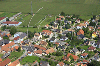
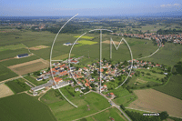
Bietlenheim
Bietlenheim is a commune with 292 inhabitants (as of 1 January 2011 ) in the department of Bas- Rhin in the Alsace region. It belongs to the canton of Brumath and community association Basse anger.
Geography
Bietlenheim located on an average altitude of 151 meters above sea level. The municipality has an area of 2.13 square kilometers. Bietlenheim located 11 kilometers south of Haguenau. The community is surrounded by the neighboring communities Weyer Home, Geudertheim and Vendenheim. The anger flows through the southern municipality. Due to the proximity of the anger is a risk of flooding. The recent floods occurred during the hurricane Lothar in December 1999.
History
Nègre writes in his toponymy générale de la France ("General toponymy of France" ) that the place name is composed of the Germanic name Betilo and place names show - home. This suggests that Bietlenheim has been established at the time of the Frankish conquest.
1570 Bietlenheim was reformed. The village belonged until 1736 to Bailliage Brumath the county of Hanau - Lichtenberg.
1793 Bietlenheim received in the wake of the French Revolution ( 1789-1799 ) as Biettenheim the status of a municipality and in 1801 the right to local self-government. In 1871 the church was incorporated into the newly created National Rural Alsace-Lorraine by the German Empire due to territorial changes through the course of the German - French War ( 1870-1871 ). The National Rural Alsace-Lorraine existed until the end of World War I (1914-1918) and was subsequently dissolved. Bietlenheim was then back to France.
Demographics
Attractions
The Chapel of Saint- Arbogast was built in 1835. Today it serves as the Protestant church. An original chapel on the same site, however, was already mentioned in 1371. In the years 1962 and 1963 the building was restored.


