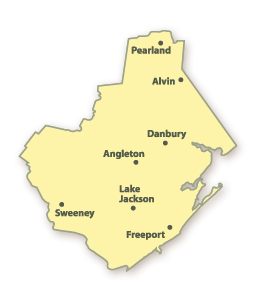
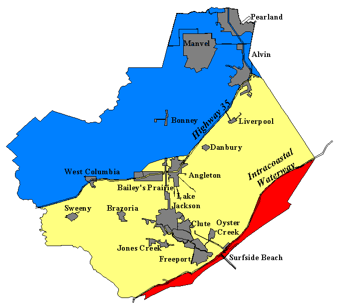
Brazoria County, Texas
The Brazoria County is a county located in the state of Texas in the United States. The seat of the county government ( county seat ) is located in Angleton.
Geography
The County is located southeast of the geographic center of Texas on the Gulf of Mexico and is part of the Houston - Sugar Land - Baytown Metropolitan Area. It has an area of 4137 square kilometers, of which 547 square kilometers are water surface. It is bordered clockwise to the following counties: Harris County, Galveston County, Matagorda County, Wharton County, and Fort Bend County.
History
Brazoria County was formed in 1836 as an original county. It was named for the Brazos River.
Demographic data
According to the census of 2000, there were 241 767 people in Brazoria County; were counted 81 954 households, and 63,104 families. The population density was 67 people per square kilometer. The racial the population was made up of 77.09 percent White, 8.50 percent African American, 0.53 percent Native American, 2.00 percent Asian, 0.03 percent of residents from the Pacific Islander and 9.63 percent from other races groups; 2.22 percent were descended from two or more races. 22.78 percent of the population are Hispanic or Latino of any race.
Of the 81 954 households out of which 40.8 per cent of children or young people who lived with them. 62.2 percent were married couples living together, 10.4 percent were single mothers and 23.0 percent were non-families. 19.1 percent of all households and 6.4 percent had someone living alone at the age of 65 years or older. The average household size was 2.82 and the average family size was 3.23 persons.
28.6 percent of the population was under 18 years old, 8.6 percent between 18 to 24, 32.4 percent between 25 and 44, 21.5 percent between 45 and 64 and 8.8 percent were 65 years of age or older. The average age was 34 years. For every 100 females there were 106.8 males to 100 females age 18 and over, there were 107.4 males.
The median income for a household was $ 48,632, and the median income for a family was $ 55,282. Males had a median income of $ 42,193, women $ 27,728. The per capita income was $ 20,021. 8.1 percent of families and 10.2 percent of the population lived below the poverty line.
Cities and Towns
- Algoa
- Alvin
- Anchor
- Angleton
- Arcola
- Ashwood
- Baileys Prairie
- Bonney
- Brazoria
- Brookside Village
- Clute
- Danbury
- Danciger
- Duke
- East Columbia
- Freeport
- Iowa Colony
- Jones Creek
- Juliff
- Lake Jackson
- Liverpool
- Lochridge
- Manvel
- McBeth
- Old Brazoria
- Old Ocean
- Otey
- Oyster Creek
- Pearland
- Quintana
- Richwood
- Rosharon
- Sandy Point
- Sugar Valley
- Surfside Beach
- Sweeny
- West Columbia
- Wild Peach Village
Reserves and Parks
- Arrington Park
- Austin Park
- Brazoria City Park
- Brazoria National Wildlife Refuge
- Clute City Park
- Crews Park
- Dads Club Community Park
- Dunbar Park
- Garland Park
- Independence Park
- Le Tufle Park
- Mac Lean Park
- McLean Road Park
- Morgan Park
- Newman Park
- Peach Point Wildlife Management Area
- Riverside Park
- San Bernard National Wildlife Refuge
- Suggs Park
- Varner Hogg Plantation State Historical Park


